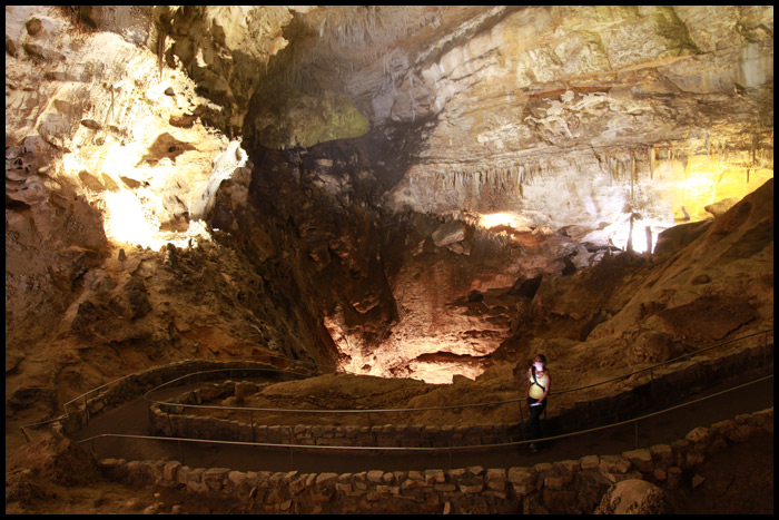
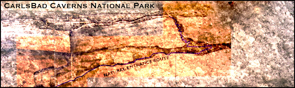
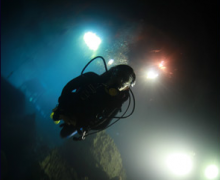
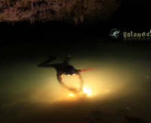
Carlsbad Caverns is an amazing cave system located in the region of the Guadalupe Mountains in southeastern New Mexico. It’s a deep, underground limestone cave that our crew decided to explore in the hopes of shooting a longer piece here in the future. Even though we prefer adventuring in less explored caves, Carlsbad was well worth a trip to New Mexico.
Bats in the Cave
One of the more spectacular things offered at the cave is a showing of about 1 million bats. They emerge from the cave each evening at dusk – making huge swarms that resemble billowing plumes of smoke from afar. You can also have breakfast at dawn to watch their return – an amazing show as the bats swarm above and fly into the cave one at a time! The bats in Carlsbad Caverns are mostly Mexican Free-tailed bats. This, like other bat caves, serves as a maternal roost, a place where only the females come to rear the young. The location of the males is unknown.
Getting a feel for the Cave: Carlsbad Caverns Video
Haley and I created this short video with timelapse photography of several images we shot in the cave. I hope it gives you a feel for the depth and feel of the cave.
http://blip.tv/play/geMC_o81AA
Cave Facts
The cave was made a national park on May 14, 1930.
The park is 46,753 acres.
There were almost a half million tourists that visited the park in 2000.
Its 750 feet froom the park center on top to the cavern floor.
Haley and Rob went to one of the biggest festivals in the area to film several videos on physics. Events included archery, axel throwing, catapults and jousting. The Carolina Renaissance Fair was a lot of fun so we thought we’d share some pictures from the event.
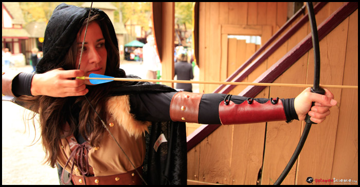
The main cast for these videos were Rob Nelson, Haley Chamberlain and guest star Celia Guzman. Celia was one of our archers for the event.
The festival had a few different archery stations. In this particular station, Haley demonstrates how potential energy is transformed into kinetic energy as the arrow flies to the target.
The Carolina Renaissance Fair is full of permanent structures that give a great sense of the renaissance.
This is one of many festivals that run around the country. Some of the biggest include those in Georgia, Minnesota, New York, Colorado, Maryland, Phoenix, Dallas, Houston and the one here in the Carolinas.
The Rough Untamed Science Video
Last but not least we wanted to share with you a rough version of what we’ve started to create from the fun at the fair. We hope this makes a big difference to kids in the future!
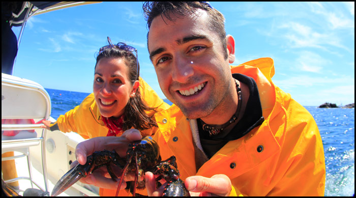
This summer some of us at Untamed Science – Jonas Stenstrom, Haley Chamberlain and Rob Nelson decided we would do a short video about animals in the pelagic zone to help compliment some of the biomes videos they are working on with UntamedScience.com and Thewildclassroom.com. All in all, our trip was amazing except for the simple fact that we didn’t see a single tuna. The following video is a quick little update that shows some of the scenery we encountered on our day-long fishing trip.
http://blip.tv/play/geMCgfrsOwA
Tuna abundance in Boston
It is no suprise that a fishing industry that revolves around a big fish like tuna might one day not exist. If the fish are there, fishermen are going to catch them. We wondered if the fishermen in this area thought there was a decline in fish stocks like the declines we had been reading about worldwide.
As it turned out, Judd, our captain has seen an increase in the last few years in tuna catches. While this might be a small increase from a century long decline, we found it unusual. Reports on the web show that tuna are declining to the edge of extinction. Some scientists predict that tuna might go extinct in our lifetime. The mediterranean has already seen dramatic drops in fish numbers. Can boston really be immune?
Our trip offshore today can’t really make us feel good about the situation. Tuna normally jump out of the water which helps fishermen find them. We spent the entire day looking and didn’t see a single tuna. But thats not to say they weren’t just somewhere else. Heck, for all we know, the white sharks that were just spotted in the area might be driving them off. It kept us from swimming in the water.
Needless to say, this has been an adventure for our film crew. We want to thank Chris Borgatti and our captain Judd for making this trip happen. We’ll be back again soon!
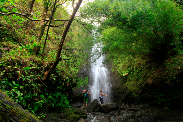
One of my favorite hikes in the islands is Ka’au crater in the back of Palolo Valley. When I was here as a graduate student I learned about this hike. It is not listed in any guide books as you have to walk through some private land and then pass some of the government no-tresspassing signs. I only list it here so that I have a link to direct friends to when they ask for the best hike in that area.
Getting to the trail head:
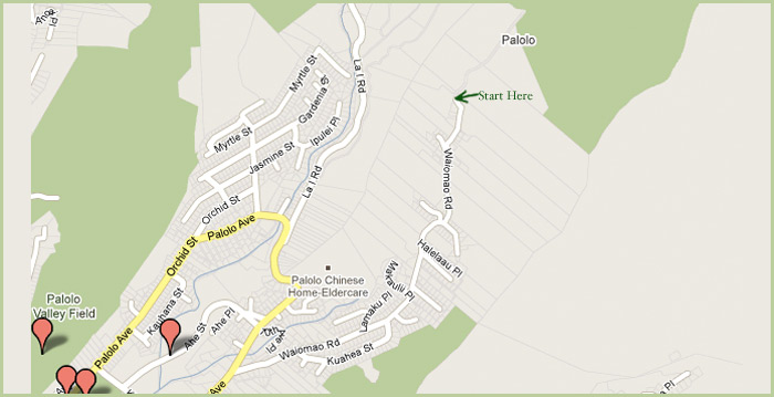
To get to the base of the hike you’ll need to drive up 10th avenue in Palolo Valley. Take a right turn towards the back of the valley at Waiamao Road. Follow it all the way down the road until it becomes a narrow single car road and past the Korean temple. When the sign says NO trespassing stop and park your car. If there is no parking here, because of residents, park further back down the road and hike up. I suggest carpooling out of courtesy to those that live up there. Pass the first sign on the road that says no trespassing. The road will split in two. Stay to the left and do not go up the hill. You will pass two houses. Be quite here. If the residents greet you just ask them politely if you can do the trail. You can’t do it without their consent. If they don’t come out, just hike up to the first fence. Walk around the fence and you’re on the trail.
The trail
For the first 45 minutes you follow a water line made by the state. It will take you almost all the way to the first of the three major water falls. Once you get to here stop and relax and continue around to the other two. At the third waterfall you’ll be climbing up the waterfall itself with ropes. Its not a hike for the weak of heart.
Once at the top of the trail, we recommend that you hike all the way to the top of the ridge. That might take you another hour. In total the climb to the top took us about 3 hours going pretty slow taking photos etc. It took 2 hours on the way home. All in all I guess its about 7 miles round trip. Great hike. If anyone does the hike, leave a comment here and let me know what you think.
Video of the Hike from Rob Nelson
The following video was taken by me in 2001. Its old and a bit silly, but it’ll give you a good overview of the hike.
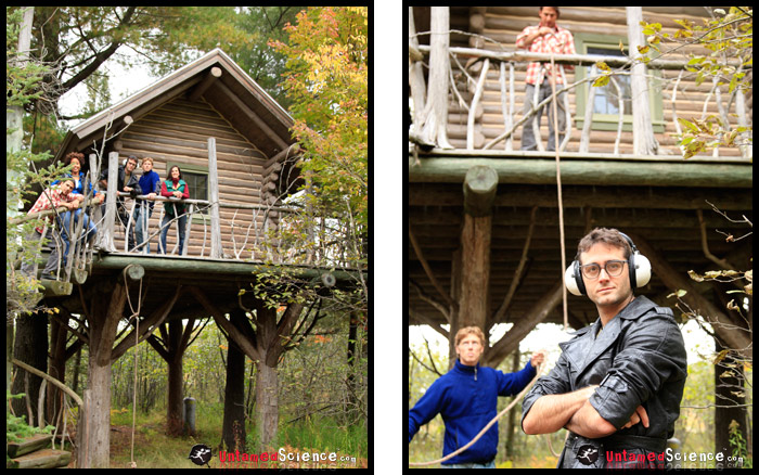
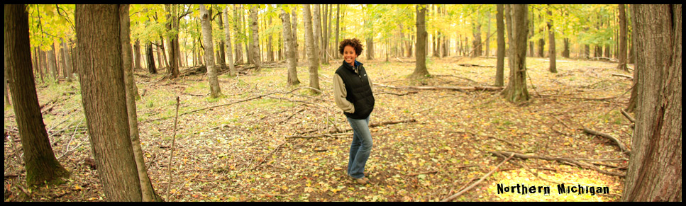
The entire crew gets together every few months to film music videos and bond as a team. We stayed in a beautiful logtreehouse in the woods working and playing.
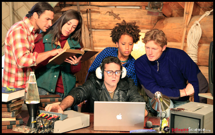
This is a shot of our set. Rob serves as central command and the crew works to get information from various places.
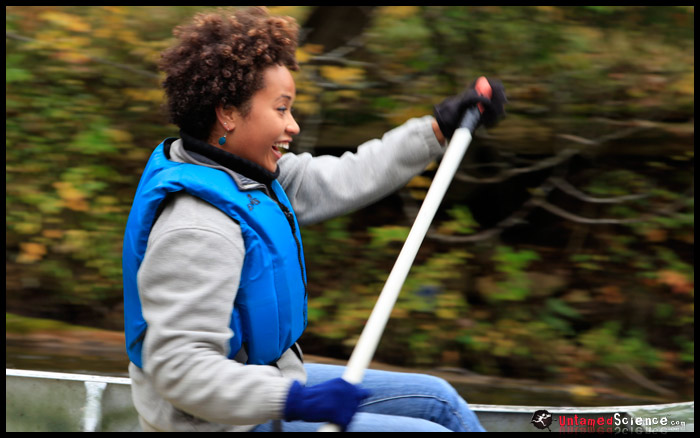
This was Danni’s first time on a river in Michigan – but not her last. She want’s to paddle this same river in the dead of winter.
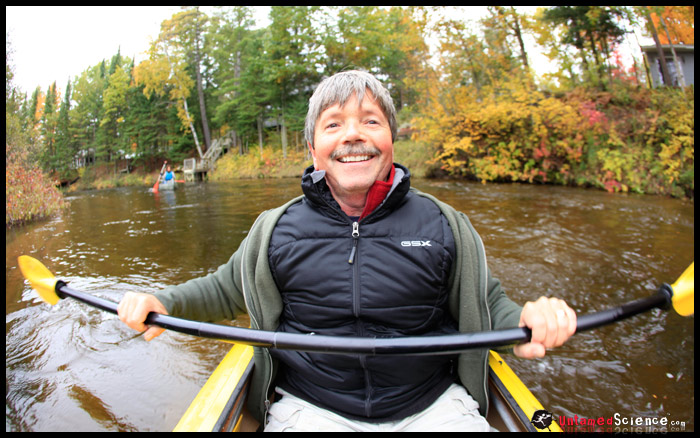
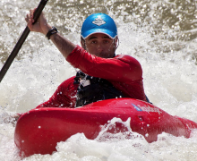
While filming a piece on Kayaking, Dan served as the cameraman’s navigator. We paddled 5 miles of pristine rivers in the area.
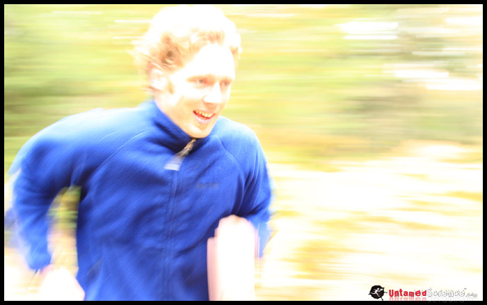
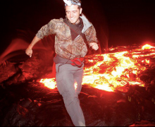
Many scenes include running through the woods. Jonas of course loves this!
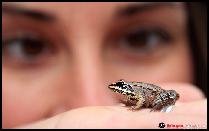
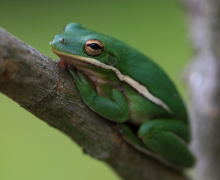
Haley found a wood frog in the area. In a few months this frog will be in freezing temperatures but survives because of a unique “antifreeze” in its blood.
This fall we’re happy to hand out some excellent Animal Planet DVD’s about film makers making wildlife films. This style of adventure and filmmaking is very much like what we do and thus we thought it was a good fit for our first prize.
To get one of the five, all you have to do is help us test our beta site. Log on to UntamedScience.com and sign in as an ecogeek through our facebook connect feature. Then add information to your profile. The 5 users with the best profile will be our winners. We’ll contact you on October 5th, 2009 to send them out to you!
ABOUT RAW NATURE
Raw Nature follows filmmakers Matt Renner, Mitch Tanen, Gianny Truttman and Anneli Gericke as they travel across the world to document wildlife professionals working to help animals survive human encroachment.
Subjects include a man dedicated to rescuing poached sloth bears turned entertainers on the streets of India, and a Sumatra biologist who’s doing everything she can to help save the orangutan population from total extinction.
Viewers will also be provided with an up-close-and-personal view of animals — from Komodo Dragons’ whose spit will kill you to white rhinos who will charge at a moment’s notice.
In addition, the series will also emphasize conservation, preservation and an understanding that the world needs to ensure its own survival.
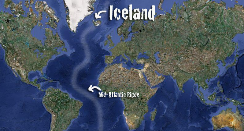
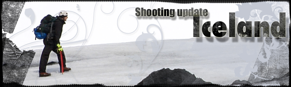
Untamed Science crew member Jonas Stenstrom recently returned from Iceland as a part of this year’s production. The country is an island, slightly larger than the state of Oregon, that lies in the middle of the North Atlantic ocean with the tectonic boundary between the North American plate and the Eurasian plate, the Mid-Atlantic Ridge, running straight through the country. In fact, it is the only place you will able to go and see the Mid-Atlantic Ridge above sea level.
This location means that geologically, Iceland is extremely active with several volcanoes, countless hot springs and geysers. The English word GEYSER is actually derived from Geysir, or Great Geysir, and the oldest known geyser in the world is located in Haukadalur Valley on Iceland. The geothermal activity also provides most of the 300,000+ people living in Iceland with cheap electricity and hot water.
Iceland also has the largest glaciers in Europe. In total, about 11 percent of the country is covered by glaciers. More than 60 percent of the country is tundra and largely uninhabited.
I went there to document Iceland’s unique geological location and was met by a country beautiful in every way with amazing nature and incredibly friendly people.
The main purposes of my trip were to document climate and why different parts of the planet experience different climates, and to take a closer look at plate tectonics and Iceland’s geological activity.
Highlights of the trip:
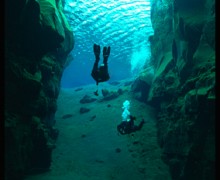
Dive in Lake Silfra
Silfra is located in Thingvellir National Park about an hour drive from the capital Reykjavik. It’s incredibly interesting nature and history has given Thingvellir a place on the UNESCO World Heritage List.
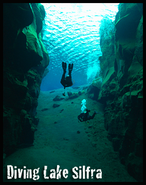
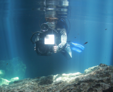
In the park lies Lake Silfra. The lake has become world famous amongst scuba divers for its incredibly crystal clear water. It also lies right on one of the fault zones that break Iceland apart, which is another reason I had to take a closer look (with great help from “Scuba Iceland” and Finni Finnbjornsson).
With us on the dive we also had underwater videographer Thorvaldur “Valdi” Hafberg with his great experience of shooting video in the waters around Iceland.
Glaciers
I also paid a visit to one of the many glaciers found on Iceland. Geared up with the right equipment we walked out on the compact ice that looks nothing like the snow and ice we are used to seeing in winter. Glacial ice is very different. And, the massive pack of ice creates its own weather systems. In our first hour we had rain twice, hail twice, snow, sunshine, storm and no wind–absolutely incredible weather fluctuations. It has to be experienced! But play it safe, glaciers can be treacherous. Right gear, training and a guide are crucial.
If you would like to experience Iceland the way we did, check out our professional contacts below:
In an attempt to make a short earth science film about volcanos, we took a trip up Mount St Helens in Washington. For those planning to climb Mount St Helens, we thought we’d document our trip so that you can be as prepared as possible for the climb.
http://blip.tv/play/geMCgZa1CQA
General Information about the Area
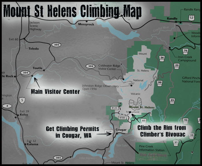
Mount St Helens isn’t like most National Parks that I’ve been to. The main visitor center is almost an hour and a half from where you’d start hiking. In fact, the access to the mountain is from small roads – none of which go around the mountain. If you were at the Johnston Observatory, it might take you 3 hours to get to the other side of the mountain. Make sure you know where you want to go when preparing to climb the mountain. We recommend making your first destination the small town of Cougar, WA.
Hiking the Monitor Ridge Climbing Route
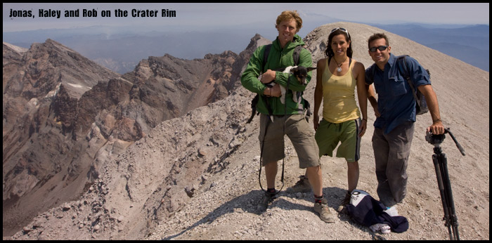
The hike to the top of the crater rim is a 4.5 mile one-way hike that takes you from 3,700 feet to about 8,300 feet at the summit. It took us 5 hours to get to the top while taking video along the way. The first 2 miles are through a beautiful old forest. The last 2.5 miles are steep and through rocky, unstable ground. The last section to the summit is ashy pumice – making it incredibly difficult to gain any forward ground. We would recommend getting to the top as early as possible as we heard that the ash starts blowing around on the summit more as the day progresses.
Getting Permits for the Climb
To hike to the rim of Mount St Helens, you need a climbing permit. The park only allows about 100 people up the mountain a day and, since its a very popular climb, you should try and get the permit well in advance. It can be purchased online at active.com for around 15 dollars each climber. Once you register online, you can pick up your permit at the Lone Fir Motel in Cougar WA. They have a Climber Registration table set up just outside the motel’s main desk.
More Video of Mount St Helens
We found a few more video pieces of Mount St Helens that we thought you’d like.This one is from National Geographic
Untamed Science went to Missoula, Montana, to visit the Biomimicry Institute.
This institute works with a great approach to finding solutions for a sustainable future. Basically the message is, find ways to solve your needs by getting help from the most experienced teacher there is – Nature.
Does this sound weird? Well, let’s give a few examples.
If we live in a hot climate we need to figure out a way to cool our houses and likewise if we live somewhere cold, we would need to heat up our houses, right? Climate controlling air-conditions are really good for this, if it wasn’t for the amount of energy used to run them and other personal and environmental costs involved.
The question was asked, “There has to be some animals that have to deal with the problem of climate control in nature?”
The observation was termite mounds in hot African savannahs.
Scientists dug into how these small architects and construction workers dealt with the heat and found that the termites were building their mounds in a way that kept the inside temperature much less than the outside temperature just by regulating the air going through the mound (not many termites have access to regular air conditioners you know…)
The principle was used to buildings and showed to work both in hot environment (cooling the houses down) and in colder areas (keeping the houses much warmer than the outside). Who would have though termites were holding on such an incredible solution to a problem concerning so many people? All we had to do was ask… or at least open our eyes to new ways of thinking
Another example is the propeller rotor. For example the giant wind turbines that make use of the wind energy that is then converted to energy we can use. We try to build the propellers as efficient as possible to harvest as much energy as possible.
So, do you think this process could have anything to do with whales? Well, as a matter of fact yes.
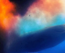
Scientists observed Humpback whales and asked themselves if the humps on their fins could serve a purpose. Research discovered that the humps actually helped the whales to glide more efficiently through the water and a conclusion that maybe the same idea could be applied to propeller rotors to be more efficient. And, it worked.
And there are hundreds of examples like this already developed, where observations in nature have led to products that we use everyday. Insulation materials, adhesive compounds, ventilation systems, building material and construction strategies, surfaces that don’t absorb water etc.
Not to mention all the undiscovered examples.
Just another great reason to Never Stop Exploring Your World!
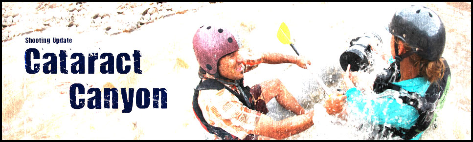
The Colorado River is known for having some of the biggest and most fearsome rapids in the country. While the Grand Canyon is usually known as being the largest and most difficult, I’ve found that many consider Cataract Canyon to have a just as tricky rapids.
On this rafting trip down Cataract Canyon, the four of us (Peter, Rob, Hazen and Jaime) decided to take on the rapids. I was along to film and be filmed, but have very little whitewater experience under my belt. The waves were looking very gentle until we hit one small set of rapids just before The Big Drops. That is where we flipped our raft. Here is the short video we took. I hope it portrays a bit of how scary it actually was.
http://blip.tv/play/gYJ+gY3YfAA
For those of you who wonder what actually happened, we hit the button hole and rolled. After we got back on the raft Peter took the throw-line and dove overboard, hoping to tie the raft up before it floated into the big drops. It got pulled away from Peter, which sent us on our way, upside-down and alone.
Luckily for us, Hazen has a lot of experience in rapids. We tried as hard as we could to eddie out on the edge of the river but had no luck for at least a mile. Finally, we got to the side and after about an hour, were able to flip it back over. This made us very worried however, to do the big drops. We ended up walking Big Drop 2 and 2.5 and slept on a very rocky and wet shoreline that night.
The next day we flipped the raft again on Big drop 3, of which the camera was packed away tightly.
I would definitely raft Cataract Canyon again, but I’d make sure I did everything I could to keep the raft upright this time.